Topographical Survey
Detailed Topographic Survey Solutions Helping Architects, Engineers & Developers Build with Confidence
Get a Free Quote From Us Today!
We aim to get back to you in 24 hours.
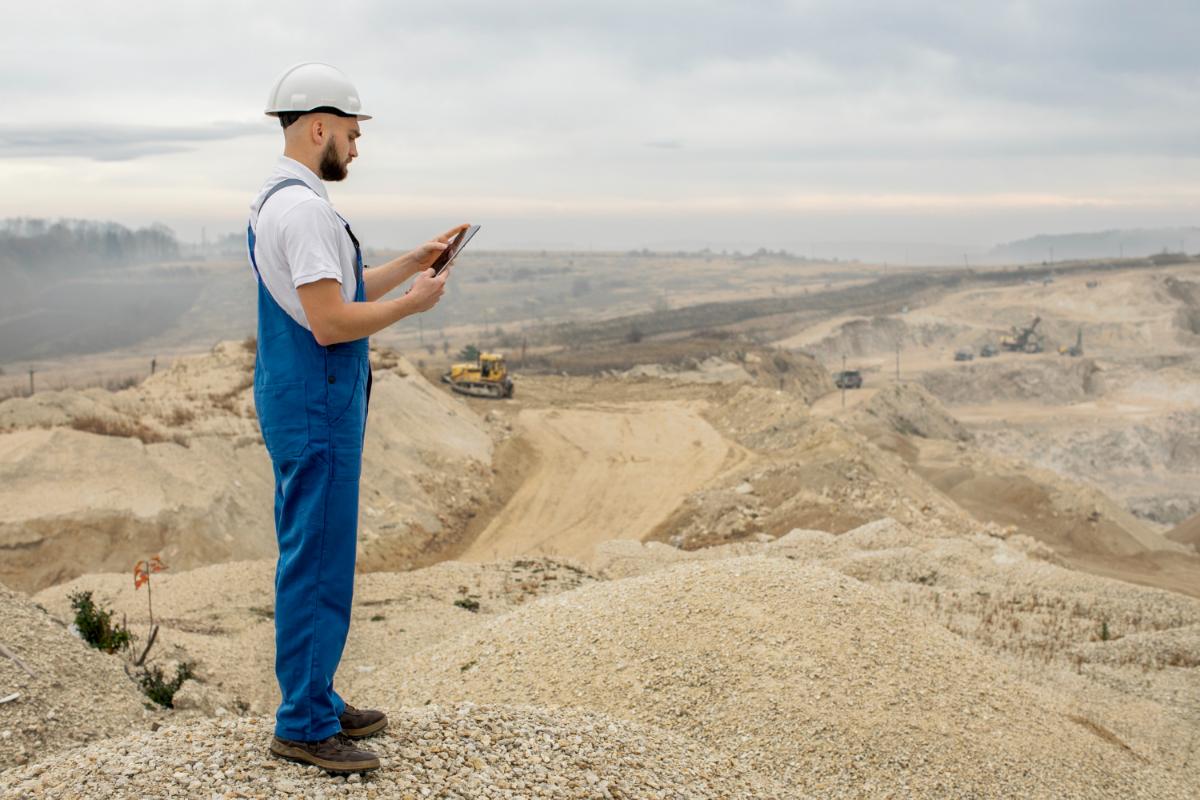
At Topographic Survey, we provide detailed land measurement and mapping services that provide a precise foundation for planning, design, and construction projects across the UK.
By providing a detailed geospatial record, our topographic survey ensures that every stage of the development process is based on verified site realities, allowing for efficient project delivery and long-term structural integrity.
What Services Are Included in a Topographic Survey?
A comprehensive topographic survey delivers a multi-layered geospatial dataset designed to support every phase of the architectural design lifecycle. Our deliverables include precise site measurements, elevation recordings, and the identification of all visible features to ensure structural feasibility.
We handle every stage of the process, from the initial data capture to the production of high-quality digital terrain models and AutoCAD drawings. Technical consultancy is provided to help clients interpret complex data, which ensures that structural engineers and local planning authorities receive the certified site documentation required for approval.
Why Should You Choose Professional Topographic Survey Services?
Choosing a professional topographic survey ensures that your project starts with an accurate foundation, reducing the risk of expensive errors during construction.
Qualified surveyors use regularly calibrated instrumentation and hold specific indemnity coverages that unvetted providers lack, which minimises the risk of miscalculating structural clearances. This expert oversight maximises project efficiency and provides a clear audit trail, which is essential for satisfying the demands of structural engineers.
How Much Does a Topographic Survey Cost?
The cost of a topographic survey ranges from £450 to over £4,000, depending on the size of the site, the density of the terrain features, and the specific level of detail required for the final plans.
Pricing is primarily driven by the time required on-site for data capture and the complexity of the post-processing phase needed to produce 3D Revit or CAD outputs.
Contact Topographic Survey to get customised prices for a topographic survey at your property.
Get a Free No Obligation Quotation Today
When Should You Carry Out a Topographic Survey?
You should carry out a topographic survey at the very beginning of the design phase, ideally before any architectural concepts or master plans are finalised. Early surveying allows the design team to identify potential site constraints like protected trees or steep slopes that could impact the building’s footprint.
This step ensures that the planning application process is supported by verifiable data, which significantly reduces the risk of rejection or the need for expensive structural redesigns later in the project.
Where Is a Topographic Survey Required Across Projects?
A professional topographic survey is required for any project that involves altering the land or constructing new permanent buildings, ranging from residential gardens to massive infrastructure schemes. This service is critical for greenfield developments, brownfield regenerations, and civil engineering works where accurate geospatial data is non-negotiable for structural alignment. By mapping the site environment, the survey ensures that piling and foundation designs are based on the actual height of the ground, preventing the financial fallout of mapping errors during the construction phase.
What Data, Levels, and Features Are Captured in a Topographic Survey?
A highly detailed topographic survey captures every critical element of the physical landscape to facilitate accurate urban design, including:
- Ground Levels and Contours – Recording elevation data across the entire site to allow for accurate drainage and volume calculations.
- Buildings and Structures – Mapping the footprints and heights of existing buildings, walls, and other permanent physical features.
- Boundaries and Fences – Establishing the precise limits of the property to prevent encroachment and define legal land divisions.
- Surface Features and Utilities – Identifying visible services, manhole covers, and site elements that impact subterranean design.
- Natural Vegetation and Trees – Documenting the location, canopy spread, and trunk diameter of trees for environmental compliance.
How Does the Topographic Survey Process Work?
The technical process for a topographic survey follows a structured workflow that includes a site assessment, precision data capture, and meticulous office-based processing. Our surveyors establish geodetic control points that provide a fixed reference for all measurements across the property relative to the national grid.
Each measurement is processed through CAD software, resulting in a detailed plan that acts as the legal and technical baseline for the entire construction lifecycle.
Request a free quote
How Quickly Can a Topographic Survey Be Completed?
A standard topographic survey can typically be completed in one to three working days, depending on the acreage and the complexity of the site. Once the field data capture is finished, the computational processing phase begins, where the raw coordinates are converted into the final digital deliverables requested by the client.
This efficiency ensures that your design cycle is not hindered, providing high-quality digital deliverables that are ready for immediate use by your design team and minimising operational disruption.
Which Industries and Projects Require Topographic Surveys?
Our topographic survey benefits a wide range of professional sectors, including residential developers, civil engineers, and local government authorities. Architects rely on the data to create contextually accurate designs, while utility companies use the maps to plan new network connections safely.
For landowners and legal professionals, the survey provides an indisputable record of site features, which is essential for land registration and resolving boundary disputes.
What Accuracy Standards and Regulations Apply to Topographic Surveys?
Every topographic survey we conduct is performed in strict accordance with the RICS Professional Statement for land measurement and mapping. Adhering to these UK standards ensures that the geospatial data is legally defensible and provides the millimetre precision required for structural engineering.
Following these recognised industry guidelines guarantees that the survey is accepted by planning departments and provides the insurance-backed certainty required for large-scale infrastructure projects.
Contact Topographic Survey for a consultation to get a topographic survey tailored to your organisation’s risks and responsibilities.
speak with our team today
What People are Saying About Us
★★★★★
"We used Topographic Survey ahead of a commercial redevelopment project and the level of detail provided was excellent. The team worked professionally on-site and delivered accurate mapping data that made planning far more straightforward. Communication was clear throughout the entire process."
Danica Grivess
London
★★★★★
"Topographic Survey delivered everything exactly when promised and the reports were easy for our architects and engineers to interpret. Their attention to detail gave us confidence before moving into the next stage of development. A dependable company with a knowledgeable team."
Amara Florence-Yu
London
★★★★★
"Our experience with Topographic Survey was smooth from the initial enquiry through to the completed survey documents. The team arrived prepared, worked efficiently, and produced reliable site information that saved us valuable time during planning. We would certainly recommend their services."
Lester Fonseca
London
★★★★★
"Topographic Survey provided a highly organised service and ensured every aspect of the land measurements was thoroughly recorded. The final data helped our project move forward without delays or uncertainty. Professional, responsive, and very easy to work with."
Charlotte Ryder
London
Our Locations
We are proud to work nationally across the UK, allowing us to ensure we can provide services to you.
For a full list of counties we cover in the UK, see below.